What Are the Old Pilings at the Mouth of the Songo River?
Beneath the water at the Songo River entrance are remnants of a much larger navigation story involving a shallow delta, a hand-worked channel, canal boats, jetties, dredging, and a river that has never stopped moving.
At the northern end of Sebago Lake, where the Songo River reaches open water beside Sebago Lake State Park, old wooden pilings remain below the surface. They do not project above the water, although boaters can sometimes see portions beneath the surface on clear days. Their history raises an obvious question: Why are they there?
Sometimes informally called pylons, the more accurate historical term is pilings, meaning timbers driven into the lake bottom as part of a structure. They are not random fence posts, and the strongest evidence does not point to an ordinary dock.
They are remnants of a long effort to make a naturally shallow, shifting river mouth navigable.
Historical accounts describe a channel dug from the Songo River roughly half a mile into Sebago Lake, with planks and driven piles supporting its sides. An 1889 visitor’s guide described a steamer passing between “long lines of brushwood jetties” to enter the river. Engineering records later documented riprap, or loose-stone, jetties after the Songo broke through beside an earlier outlet. Together, those accounts describe an evolving system that guided canal boats and passenger steamers across a sandy delta that continually built bars, shifted its course, and resisted every attempt to make it permanent.
The pilings are therefore best understood not as one isolated ruin, but as surviving pieces of an engineered entrance that changed over time.
This is the story of why that entrance was needed, how it worked, why parts of it became hazardous, and why the Songo mouth remains a complicated place to manage today.
The short answer
The old wooden pilings at the Songo River entrance are associated with a man-made navigation channel across the shallow Songo River delta.
The waterway formed the northern continuation of the Cumberland and Oxford Canal route. Boats could travel from Portland Harbor up the canal and Presumpscot corridor, cross Sebago Lake, enter the Songo River, pass through Songo Lock, and continue through Brandy Pond and Long Lake toward Naples, Bridgton, and Harrison.
But the natural mouth of the Songo was too shallow and unstable for dependable commercial navigation. A channel was excavated from the river into deeper lake water. Historical summaries describe its sides as plank-faced piling: rows of driven timbers supporting wooden planks that helped define the navigable cut. A period travel account also called the entrance works brushwood jetties, suggesting that timber, brush, and possibly stone were used together or in successive repairs.
Not every submerged remnant has been dated, and the entrance was repaired and altered more than once. Some surviving material may belong to later work rather than the first channel. The essential purpose, however, was navigation through a moving sand delta.
First, why is the river mouth so shallow?
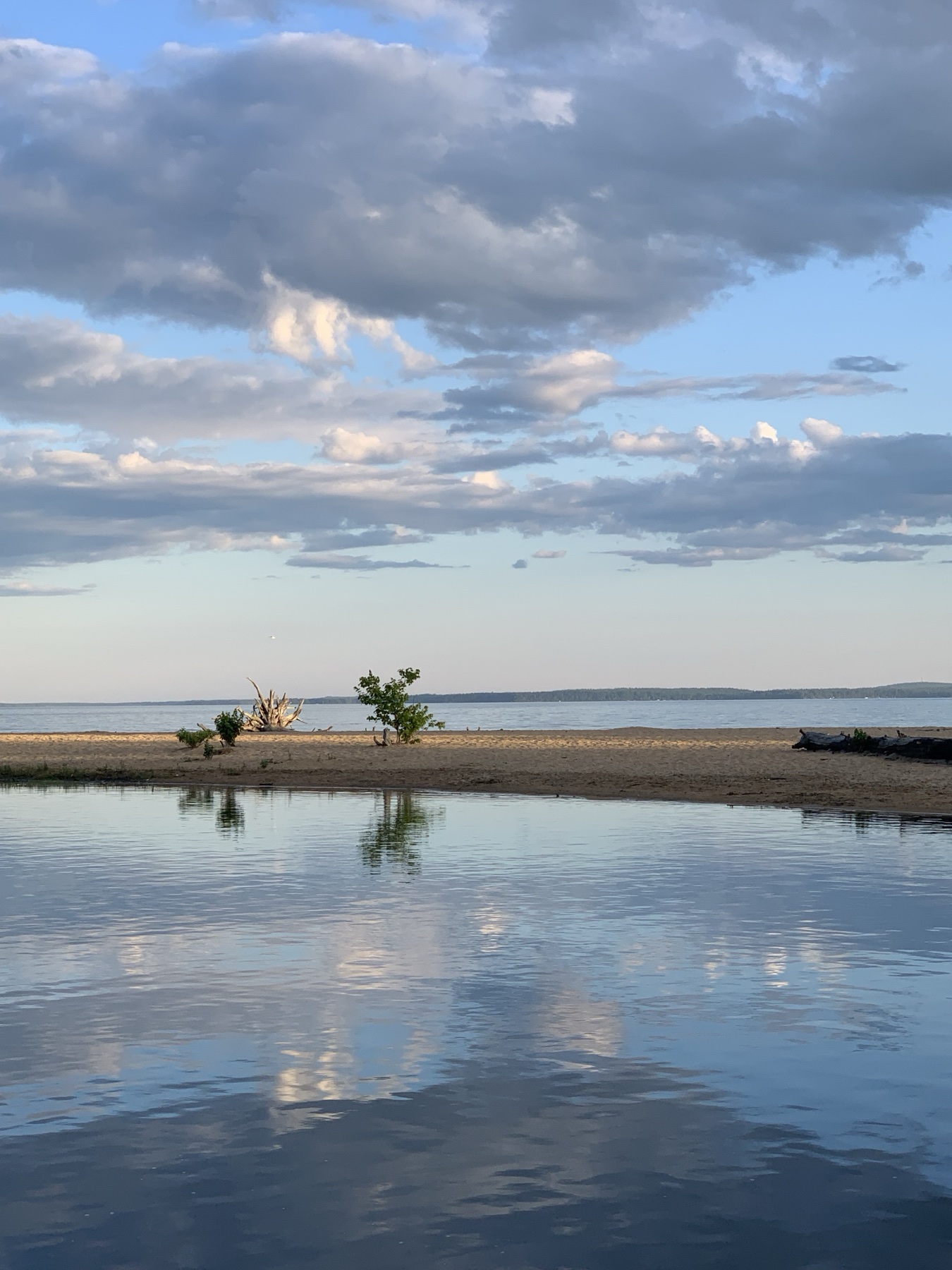
The answer begins thousands of years before canal boats.
Sebago Lake State Park occupies part of a large deposit of sand and gravel left by glacial meltwater. The Songo River later cut through that older deposit and carried younger sediment into the lake. When river water reaches the open lake, its current slows. Sand and other material settle, gradually building a delta.
That process is natural. It produces the broad shallows, bars, and sandy spit familiar to boaters and beachgoers at the north end of Sebago Lake.
Modern aerial imagery reveals how far the Songo River delta extends beneath Sebago Lake. The visible beaches form only its exposed edge. Sand and shallow deposits continue far offshore, helping explain why the historic navigation channel had to extend roughly half a mile from the river mouth before reaching deeper water.
The mouth is not a fixed pipe with permanent banks. It is a meeting place between flowing river water, lake waves, sediment, changing water levels, ice, floods, and boat traffic. Each can reshape the entrance.
The Maine Geological Survey has studied the park shoreline and Songo delta for decades. Geophysical work described the modern river delta building outward over older glacial deposits. A 1912 engineering study observed the same place on a human time scale and estimated that the delta was then extending the shoreline by about 30 feet per year.
That was an observation from the early 20th century, not a present growth rate. It nevertheless shows how quickly the entrance could change when commercial navigation still depended on it.
A river route before the canal
The Songo was a travel corridor long before engineers modified it. It connects Sebago Lake with Brandy Pond and Long Lake, while the Crooked River joins the Songo above the State Park section.
Its famous bends made the trip picturesque, but they also made it slow. Nineteenth-century descriptions emphasized how the river twisted repeatedly across a much shorter overland distance. Sails were of little use within the narrow turns, and there was no towpath along the river as there was beside excavated portions of the canal.
When the Cumberland and Oxford Canal was planned, the Songo became the critical natural link between Sebago Lake and the inland lakes to the north.
The Cumberland and Oxford Canal changes the scale of travel
The Cumberland and Oxford Canal opened in the early 1830s. Its central purpose was to connect the interior with Portland, giving farms, forests, mills, merchants, and communities a practical freight route to the coast.
The canal proper ran about 20 miles from Portland toward Sebago Lake and used a series of locks to overcome the roughly 260-foot elevation difference. From the head of the canal, boats crossed Sebago Lake and entered the Songo on their way to Brandy Pond and Long Lake.
Songo Lock, built around 1830, lifted boats past a natural change in elevation. It is the only operational lock remaining from the system and is listed in the National Register of Historic Places.
The lock solved only one problem. Boats still had to reach it.
Historical accounts say workers blasted the Songo’s shallow “ripplings” in the 1820s. At the lower end, the wide and sandy river mouth presented another obstacle. Before later changes in the regulated level of Sebago Lake, it was so shallow that a channel had to be dug outward into the lake.
That is where the pilings enter the story.
How the half-mile channel worked
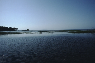
A Frye Island Historical Society account, compiled from regional histories and archival material, describes a channel extending about half a mile from the mouth into Sebago Lake. Its sides were supported by plank-faced piling.
There is also a revealing description written while the steamboat route was active. In Here and There in New England and Canada, published in 1889 by the Boston and Maine Railroad’s Passenger Department, M. F. Sweetser wrote that the steamer approached the Songo “between long lines of brushwood jetties.”
The two descriptions are compatible. Picture roughly parallel structural edges defining a deeper cut through the shallows. Driven piles could support plank facing and contain brush, stone, or other fill. Historically, such structures marked the route and helped resist loose sediment. Their materials and profiles could change as sections decayed, shifted, or were repaired.
They no longer maintain an open navigation cut. Sand has filled the former channel area, and the surviving walls are no longer retaining sand away from the route as they once did.
This did not turn the approach into a modern harbor. It created a narrow route through which shallow-draft vessels could work their way between the river and deep lake water.
Canal boats were designed for those constraints. They were long, narrow, flat-bottomed, and built to draw little water. On open lakes they could use sails. In the canal they were towed by horses or mules. On the Songo and its lake approach, crews relied on long poles, often around 20 feet long, iron-pointed at one end and padded at the other.
A boatman planted the pole into the bottom, braced the padded end against a shoulder, and walked along the gunwale to force the boat forward. Passengers were sometimes recruited to help.
The entrance works therefore did more than mark the way. They helped define a corridor where heavy, awkward craft could be poled, and where steamers were later piloted, across a shallow and otherwise poorly defined delta.
Were the pilings built in 1830?
Probably during the broad era of canal navigation, but the exact date of the surviving timbers should not be claimed without a plan, construction record, or scientific dating.
The entrance was altered repeatedly. Wooden works decay, ice damages them, floods change the channel, and dredging projects replace or remove parts. A submerged pile remaining today may be from an original phase, a later repair, or a subsequent navigation improvement.
There is also evidence of more than one construction form at the mouth.
By 1889, the entrance was plainly substantial and conspicuous enough for a travel writer to describe long lines of brushwood jetties. That establishes the presence and general arrangement of the works during the steamboat era, but it does not prove when each section was built.
In 1912, U.S. Army engineer Lewis M. Adams wrote that the mouth had been improved with “simple riprap jetties.” According to his account, the jetties were added after the river broke into the lake beside its former outlet.
That wording describes stone structures intended to stabilize or guide a shifted channel. It differs from plank-faced piling and brushwood construction, although stone may have filled or reinforced timber-framed works and later jetties may have occupied a changed alignment.
The most accurate conclusion is that the lower Songo was an engineered landscape with several generations of work. It would be inaccurate to assume that every remnant belongs to a single construction project.
Congress takes notice of the Songo route
By the 1870s, the original canal system was losing ground to railroads, but the connected lakes and Songo route still mattered.
In 1876, Congress authorized a survey of the “Songo River, and the channel leading from Long Lake to Sebago Lake, Maine.” The wording is revealing. Federal lawmakers identified both the river and its connecting channel as subjects for navigation study.
The appropriation did not by itself create the pilings, and the full resulting survey still needs to be matched to the surviving structures. It does confirm that the route’s depth and condition had become a public engineering question.
Travel did not end with the freight canal. Rail service brought visitors to Sebago Lake Station, and steamboats carried them across Sebago Lake and through the Songo to inland hotels and towns. The waterway shifted from primarily commercial freight toward passenger travel and tourism.
A river that would not stay put
The clearest technical description of the Songo’s behavior comes from Adams’s 1912 paper, “Navigation Companies vs. Water Power Users, Sebago Lake, Maine.”
The title reflects a long conflict. Navigation interests wanted dependable water depth. Power companies downstream wanted to store and release Sebago Lake water for mills. A fixed lake level that benefited one user could disadvantage another, and changes at the outlet affected conditions throughout the system.
Adams described the Songo’s bed and banks as unusually unstable. Former bends remained visible. In other places, the current appeared ready to cut across a bend during a future Crooked River flood. Six small bars were noted in the river. At the mouth, the delta kept advancing.
The study considered bank protection, dredging, and construction of a low-lift lock and movable dam to preserve navigation while protecting water available for power.
This explains why a one-time excavation could never be a permanent solution. The river supplied new sediment. The lake reworked it. Bars formed. Banks failed. The outlet shifted. Human works redirected the current, but the current continued to reshape the works.
Lake-level changes and why the history can be confusing
Many short histories say simply that Sebago Lake was raised to make the canal navigable. That is broadly true, but the detailed history is more complicated.
Control structures at the outlet evolved from canal-era works into later power-company dams. They changed the range and timing of lake levels as well as the elevation at which water could be held. Historical sources sometimes combine separate construction phases or use different elevation references, producing apparently conflicting figures.
The cautious conclusion is this: regulation of Sebago Lake improved the navigation system, but it did not eliminate the shallow Songo approach.
A historical account of a later canal-boat excursion says that even after the lake had been raised, vessels still followed the half-mile channel from the river mouth to deep water. On the return trip, darkness and poor visibility contributed to the boat grounding on the channel bank. Passengers had to be taken ashore in rowboats.
The episode captures the channel’s limitations. It was functional, but narrow, shallow, and difficult to follow without modern aids.
From useful structure to low-water hazard
As commercial use declined, the pilings lost their original purpose. The planking deteriorated or disappeared, while individual piles remained.
The Frye Island historical summary says the piles became hazardous to boats at low water and were eventually removed. It does not give a date or state that every timber was taken out. Surviving piles may represent sections that were left, later repairs, or structures from another phase of the entrance works.
Wooden piles can be especially deceptive. The surviving pilings are below the surface and therefore cannot be judged from shore or used as reliable visual markers. Ice can break timbers, decay can leave jagged tops, and sediment can bury or expose different sections beneath the water.
The practical concern is clearance. As Sebago Lake’s water level drops, less water remains above the submerged timbers. The entrance channel is marked, but its buoys float and can shift or move off their intended positions. That means a boat can remain between the buoys yet still choose a path that passes too close to, or over, one of the submerged pilings.
Maine’s navigation rules describe lateral buoys as markers for the sides of a defined route, and the State asks boaters to report damaged or off-station buoys. The markers are essential guidance, but they should not be interpreted as a guarantee that every possible line between them has the same depth or is free of submerged hazards. Boaters should proceed slowly and cautiously, watch the current markers, avoid assuming their position is exact, and seek current local guidance when lake levels are low.
Maine’s navigation markers, rather than the historic piling alignment, are the current instructions to boaters. Prudent operation remains essential when markers move or water levels change.
Dredging: the recurring debate
The Songo’s maintenance problems did not disappear with the canal boats.
For decades, Songo River Queen owner Frank Gerrish used dredging equipment to keep parts of the Songo route and the Naples Causeway area open for larger vessels. A 2010 newspaper account reported that the State had once paid him annually for dredging from the Causeway toward Sebago Lake.
By the 2000s, dredging had become a public controversy. Business owners argued that accumulated sand and submerged material restricted navigation and worsened flooding. State officials disputed claims that the river’s condition was the main cause of particular floods. An underwater contractor recommended a hydrographic survey before anyone attempted to price or design a major project.
Those disagreements matter because “just dredge it” sounds simpler than it is.
Dredging can temporarily deepen a route, but it does not stop a delta from receiving more sediment. It can disturb habitat, increase turbidity, move contaminated material if any is present, affect adjacent erosion, and require repeat maintenance. Work in a protected river and lake also requires environmental review and permits.
The old channel was built when navigation and commerce dominated the decision. Any modern proposal must also consider habitat, invasive plants, water quality, drinking-water protection, archaeology, recreation, public safety, cost, and who will maintain the work afterward.
The nearby beach has its own story
Songo Beach has experienced significant erosion. Maine’s Bureau of Parks and Lands and the Portland Water District are testing a living-shoreline approach using root wads, long logs, woven branches, and native plantings to capture sand and absorb wave energy.
Some of those new structures include vertical wooden posts. They are modern shoreline-restoration features and should not be confused with the old navigation pilings at the river entrance.
The two stories do share an important theme. Sand at the north end of Sebago Lake is always moving. Nineteenth-century engineers tried to hold a navigation cut through it. Twenty-first-century managers are trying to retain it on an eroding beach.
Why not simply remove everything that remains?
Removal may sound obvious if a structure no longer serves navigation, but several questions come first:
- Who owns or has jurisdiction over the structure?
- Is it a documented historic resource or part of an archaeological site?
- Would pulling the piles disturb sediment, habitat, or invasive plants?
- Would removal alter currents, channel edges, or erosion?
- Is the structure more dangerous in place, or during and after removal?
- What permits and seasonal restrictions apply?
The Songo and Crooked River corridor receives special protection under Maine’s Natural Resources Protection Act. Work in, over, or adjacent to the water may require state and federal review. Because the mouth is historically significant and environmentally sensitive, a responsible decision would begin with a current underwater survey and agency consultation, not assumptions about what remains below the surface.
What can visitors see today?
The historic pilings are below the surface; visitors should not expect to see a row of old posts standing above the water. On clear days, boaters entering the Songo from the main lake through the marked channel may be able to look down and see portions of some pilings beneath the surface. That visibility depends on water clarity, sunlight, depth, angle, and lake conditions, so it should never be treated as a dependable way to avoid them.
The surrounding landscape is easier to observe: the broad, shallow river entrance, sandy delta, modern navigation markers, and nearby State Park shoreline. Buoys, fragment-control equipment, and shoreline-restoration posts may also appear in the general area, but they are not the historic pilings. Because the channel buoys can shift, their visible positions should not be used to infer the exact underwater position of every piling.
Visitors can view the Songo River and lake shoreline from Sebago Lake State Park, but should not climb on, tie to, move, or attempt to inspect old structures from the water. Boaters should follow posted restrictions and official markers. Paddlers should be aware that the river carries motorboat traffic and that wind can build quickly after leaving the protected river for open Sebago Lake.
Why the pilings matter
The submerged pilings are easy to pass without realizing they are there. Seen in context, they connect several layers of Sebago Lake history.
They speak to the physical geography of a shallow delta. They recall the ambition of a canal system linking western Maine with Portland Harbor. They show how crews once poled loaded boats through a narrow channel. They mark the transition from freight to steamboat tourism. They also reveal the limits of engineering in a river that continually moves sand and redraws its mouth.
The most honest answer to “What are those pilings?” is therefore longer than a label.
They are surviving evidence of an old navigation approach, part of a changing system of channel piling, planking, dredging, and jetties built to carry boats across the Songo River delta. What remains today is incomplete, altered, and still worthy of careful documentation.
Frequently asked questions
What is the correct name for them?
“Piles” or “pilings” is the accurate term for these driven structural timbers. “Pylons” is sometimes used informally, but it is not the historical engineering term for the entrance works.
Were they part of Songo Lock?
They were part of the broader navigation route, but they were not the lock itself. Songo Lock sits upstream near the Crooked River confluence and lifts boats between the lower and upper portions of the waterway. The river-mouth works helped boats cross the shallow delta between Sebago Lake and the Songo.
How old are they?
The navigation works date to the canal and steamboat eras, beginning in the 19th century, but the exact age of each surviving timber is unconfirmed. Repairs and replacements almost certainly occurred.
Why is the channel shallow again?
Because the Songo continually delivers sediment to a natural delta. Dredging can deepen a route, but sand and silt keep moving. Water levels, floods, ice, waves, bank erosion, and vegetation all affect local depth.
Are they dangerous?
Historical accounts say old piles became low-water hazards and that some piles were removed. Surviving pilings remain a practical concern because falling water levels reduce the clearance above them. The channel is marked, but floating buoys can shift; remaining between the markers does not guarantee that every possible boat path avoids the submerged timbers. Use a slow, prudent speed, observe current markers and posted restrictions, and seek current local guidance, especially during low water.
Are the pilings causing Songo Beach erosion?
The reviewed sources do not establish that. Songo Beach erosion is being addressed through a separate state living-shoreline project. It would take site-specific coastal or lake engineering analysis to attribute present erosion to old river-mouth works.
Can the pilings be removed?
Possibly, but removal would require ownership, historic-resource, safety, sediment, habitat, invasive-species, and permitting questions to be resolved. The corridor is environmentally protected, and work in the water cannot be treated as simple debris removal.
A final note on what is still unknown
Local history often begins with a remnant, sometimes hidden below the surface, and a story passed from one boater to another. The story may be broadly right while compressing several different structures and a century of repairs into one explanation.
The written record clearly establishes an excavated lake approach, plank-faced piling, long lines of brushwood jetties by 1889, recurring maintenance, and riprap jetties at a shifting outlet by 1912. What it does not establish is the construction history of every submerged timber that remains today.
That distinction matters. It leaves room for a dated photograph, original drawing, park maintenance record, or archaeological survey to make the account more precise. If you have an old image that clearly shows the Songo entrance, or a family record from someone who worked on the channel, Visit Sebago Lake would be interested in learning more.
Sources and further reading
- U.S. Congressional Record: 1876 authorization for a Songo River and channel survey
- M. F. Sweetser, Here and There in New England and Canada (1889)
- Lewis M. Adams, “Navigation Companies vs. Water Power Users, Sebago Lake, Maine” (1912)
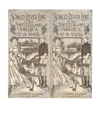
- C. L. Goodridge, Songo River Line to the Switzerland of America Up in Maine (1912)
- National Register of Historic Places: Songo Lock nomination
- Maine Geological Survey: The Geology of Sebago Lake State Park
- Geological Society of Maine: Geologic Studies in the Sebago Lake Region
- Maine Geological Survey: Songo River mouth spit photograph, 1993
- Frye Island Historical Society: Cumberland and Oxford Canal history
- North Bridgton Historical Society: Steamer Fawn and early Songo navigation
- Maine Bureau of Parks and Lands: navigational aids and waterway markers
- Maine Bureau of Parks and Lands: Sebago Lake shoreline restoration
- Maine law: specially protected outstanding river segments